Projects
AIRS Fusion Products
We have the processing infrastructure in place to produce AIRS-CrIS fused temperature products and AIRS-CrIS fused water vapor products for the continental US, and for oceans in the sub-tropics (30N to 30S). (At present the latter is only for certain cloud regimes because uncertainty information is only available from field campaign data representing those regimes.) Each vertical level (altitude) will be processed independently. Processing will commence as soon as CLIMCAPS data become available, and will cover 2012-present. At the same time, we will begin the process of expanding land coverage globally.
|
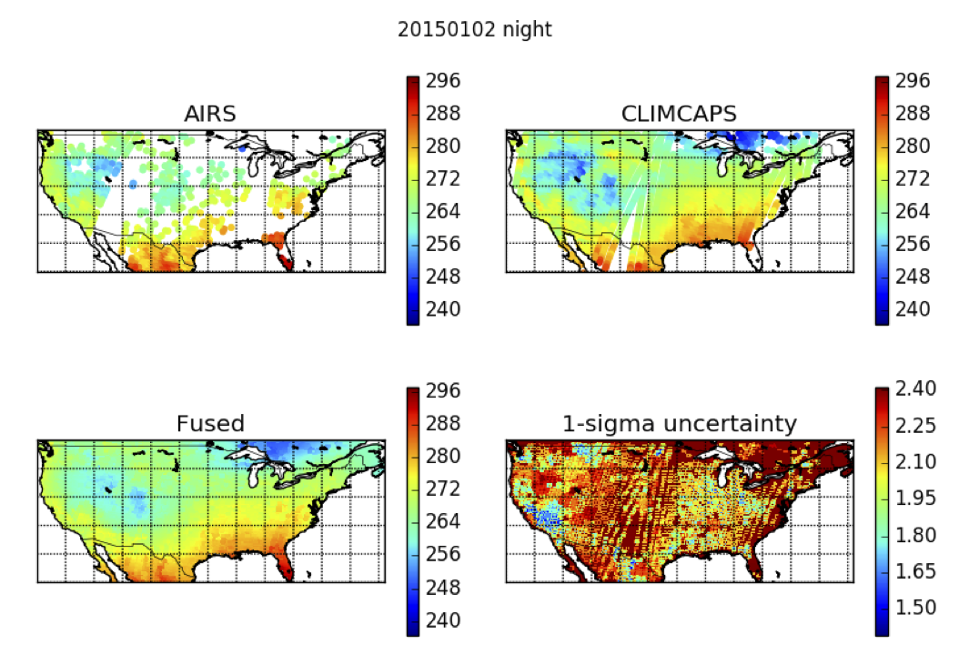
Top left: AIRS near-surface temperature estimates over CONUS at night on January 2, 2015. Top right: CrIS near-surface temperature estimates from the CLIMCAPS retrieval algorithm, over CONUS at night on January 2, 2015. Bottom left: Fused estimates using the Spatial-Statistical Data Fusion (SSDF) algorithm. Bottom right: Uncertainties associated with the fused estimates. |